Click on the pictures or titles below to bring up
a higher resolution map with more information, price and a PayPal button to
purchase the map via credit card or bank transfer.
1740
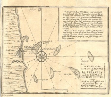
"A Plan of
the City and Harbour of La Vera Cruz and the Castle of San Juan de Ulua
Being the Key of Traffick and the Principal Port of New Spain Lat:
19°:10'"
1740
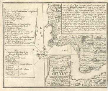
"An
Exact Draught of the Castle of San Lorenzo ye Village and River of
Chagre with the Situation of Adml Vernon's Ships in ye Attack of the
Fort March 24. 1740. by R.T. & Sent over in the Diamond Man of War..."
1749
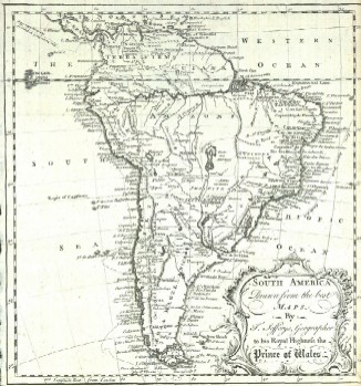
"South
America Drawn from the Best Maps, by T. Jefferys, Geographer to His
Royal Highness the Prince of Wales"
1753
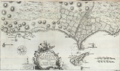
"The Port
of Callao, in the South Sea; with the Adjacent Islands, Rocks & Coasts,
to the Windward and Leeward, and the Soundings in Fathoms: Drawn by
Order of His Catholic Majesty"
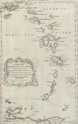
1756
"A Map of
the Caribbee Islands; Shewing which Belong to England, France, Spain,
Dutch & Danes, Collected from the Best Authorities; by Thos. Jefferys,
Geographer to His Royal Highness the Prince of Wales"
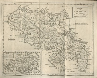
1759
"A Map of
Martinico, from the Latest and Best Authorities"
A nicely detailed antique map of the current island of
Martinique with an inset map of part of Guadeloupe
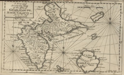
1759
"A New and
Accurate Map of the Isles of Guadeloupe, Marie-Galante &c. from the Best
Authorities"
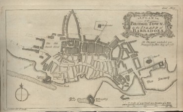
1766
"A Plan of
Bridge Town, in the Island of Barbadoes"
1770
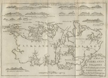
"A Map of
Falklands Islands in the Latitude of 51°, 22' South, Longitude 64°, 30'
West; from the Latest Observations"
1778
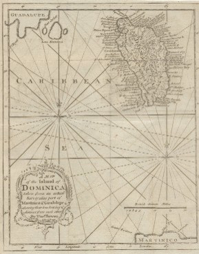
"A Map of
the Island of Dominica, Taken from an Actual Survey: Also Part of
Martinico & Guadaloupe Shewing their True Bearing & Distance from each
other. By Thos. Bowen"
1778
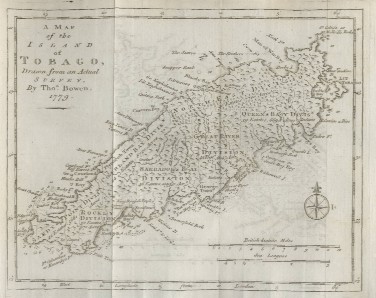
"A Map of the
Island of Tobago, Drawn from an Actual Survey, by Thos. Bowen, 1779"
Map is dated 1779 but it was published
in December 1778
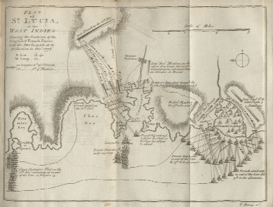
1779
"Plan of St.
Lucia, in the West Indies: Shewing the Positions of the English & French
Forces with the Attacks Made at its Reduction in Decr. 1778"
Revolutionary War battle between French
and British Armies and Fleets
Back to Top of Page
Back To Maps Index